Leave comments or report a bug

Simply leave your comments below. If the feedback is about a bug, please provide the steps you took so we can replicate.

Upload files

You can use CTR+V to paste a screenshot from your clipboard directly into the textarea above. Otherwise you can upload a file from your computer below.

Twin Waters Mangroves at sunset

Twin Waters Mangroves at sunset

Waterways and wetlands

Waterways and wetlands are our rivers, canals, lakes and water bodies.

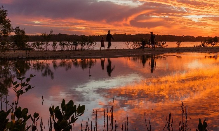
The Sunshine Coast features many natural waterways and wetlands, as well as man-made channels, canals and lakes.

Our region has catchments of five major waterways: the Maroochy and Mooloolah Rivers, the upper Mary and Stanley Rivers and the Pumicestone Passage. They support a wide range of habitats, including:

  • Estuaries and freshwater pools and riffles, and
  • Wallum, paperbark and sedge wetlands.

Waterways and wetlands provide homes for our aquatic animals, for example, fish, crustaceans, shellfish, water birds, frogs, turtles and aquatic mammals. Our habitats provide for 8 plants and 21 animals that are rare and threatened aquatic species.

They also support streamside - riparian areas. Riparian areas are important as they filter pollutants. Their vegetation also helps to reduce erosion and give shade for water-based habitats.

Waterways and wetlands are great for swimming, boating and fishing. Residents and visitors can also enjoy walking or cycling on foreshores.

Related projects

Region-wide

Wetlands to be restored and protected

Council has secured 120 hectares of land in the Blue Heart for restoration and conservation of wetlands for habitat, a healthier Maroochy River and a place to connect to nature.

Region-wide

The Environment and Liveability Strategy Refresh Project 2023

New inclusions for the Sunshine Coast’s blueprint setting the future for our environment and liveability.

Region-wide

The sustainability projects defining Sunshine Coast’s future

The Environment and Liveability Strategy Annual Report 2022/23.

Region-wide

World-first ecosystem services mapping

A mapping product to explore and understand the different services provided by our ecosystems.

232591D6-80AF-41D6-826F-11EC387AC4BD

Region-wide

A snapshot of achievements for 2021/22

Counci has released the Environment and Liveability Strategy Annual Report.

RESET project

Region-wide

Regional Erosion and Sediment, Education and Trial (RESET)

A purpose-built erosion and sediment control training facility and education program.

You may also be interested in

Biodiversity

Biodiversity is the variety of all life plants, animals, fungi and microorganisms.

Flooding and stormwater

Flooding occurs when water flows over land that is normally dry. Stormwater is runoff from rainfall.

Adaptation and resilience

Adaptation and resilience is our community’s ability to respond and adapt to a changing climate.