Moffat Beach
CoastSnap Community Beach Monitoring Program
A citizen science project to capture changing coastlines
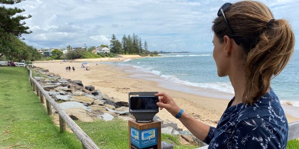
Council monitors changes to our coastline and beaches - now using CoastSnap our beach-loving community can help. CoastSnap is a beach monitoring program that turns phones into coastal monitoring devices.
At any of our four CoastSnap stations, beachgoers can take photos on their smartphone. The photo is then uploaded onto a centralised database via the free CoastSnap app.
CoastSnap compiles the images into time-lapse videos to track changes to our shoreline. This shows how beaches change and recover after severe weather or big tides. It also reveals impacts of long-term environmental change such as sea level rise. This valuable information complements council’s current beach monitoring program.
CoastSnap relies on repeat photos of the same location to track changes. Everyone is encouraged to become a citizen scientist and start snapping.
CoastSnap stations are located at:
- Moffat Beach (Beach Access 274, next to the shower)
- Point Cartwright, Buddina (Beach Access 199)
- Alexandra Headland (Beach Access 156, next to Alex Skate Park)
- Coolum beach (between Beach Access 81 and Coolum Beach Surf Club)